


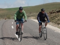
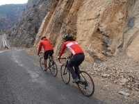
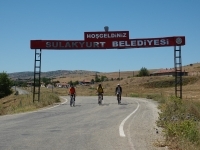
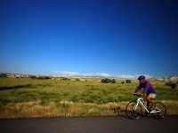
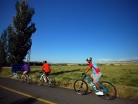
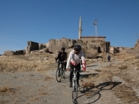
Bike Routes

Add To My To Do List
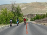
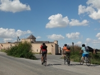
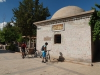
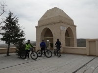
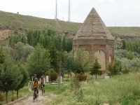
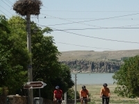
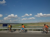
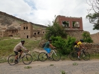
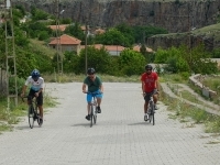
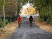
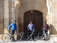
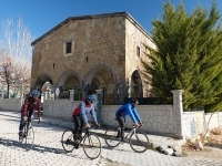
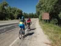
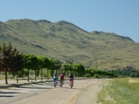
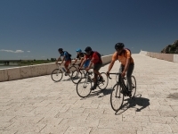
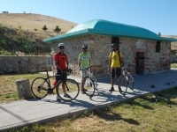
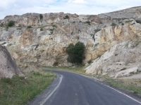
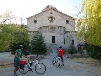
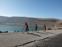
Aksaray
Difficulty Level
Length: 38 km
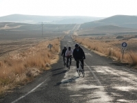
Accompanied by magnificent views, this route starts in the city center of Aksaray. He visits the Tomb of Somuncu Baba, one of the Anatolian saints, and proceeds toward the countryside. Breathing the fresh air of the countryside, the route, which proceeds
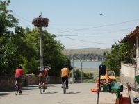
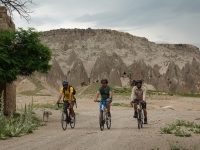
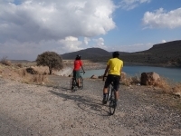
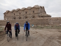
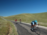
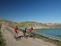
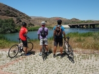
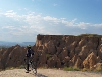
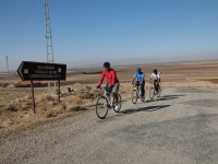
#2 Güvercin Kayası (Çatalsu) - Büyük Deller (Demirci Village) - Aşıklı Höyük - Ihlara
Add To My To Do List
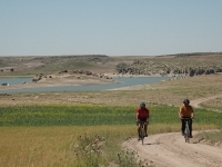
Güvercin Kayası
Difficulty Level
Length: 41 km
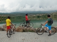
The fun route, which starts in the prehistoric settlement with the magnificent view of the Mamasin Dam, proceeds towards the volcano of Hasan Mountain, accompanied by ups and downs. After circumnavigating the 7200-year-old Büyük Deller (5200 BC - 3rd cent
Gülağaç
Difficulty Level
Length: 42 km
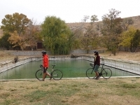
The route, where you can take unique photos, starts from the Gülağaç District and continues on an undulating route, passing the Bekar Sultan Tomb, located between two mounds (ancient settlement under the ground) and two lakes. The road starts climbing byp
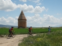
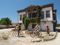
Alayhanı
Difficulty Level
Length: 25 km
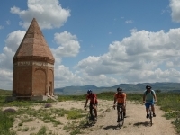
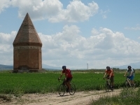
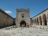
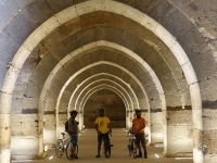
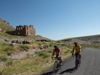
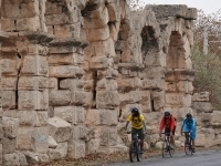
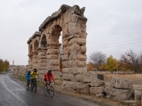
The route, which provides the opportunity to see the exquisite examples of Seljuk structure caravanserais that protected and watched over the Silk Road travelers and traders for hundreds of years, starts from the Alay Han caravanserai, which is 500 m away
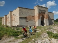
Aksaray
Difficulty Level
Length: 32 km
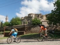
Starting from the city center of Aksaray, the route reaches the caravanserai, which takes its visitors on a journey through history with its summer-winter sections, bath, and mosque. The trail gives you a taste of another world while climbing on a gentle
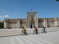
Aksaray
Difficulty Level
Length: 45 km
When you enter the route on the Silk Road, the Sultanhanı Caravanserai, which is the largest caravanserai in the world and in Turkey, spread over 4866 m² of ground area, comes into view after a short while.
Aksaray
Difficulty Level
Length: 42 km
The route, which has a mystical spirit, starts from the tomb of the famous mystic and poet Yunus Emre, a student of Taptuk Emre, one of the famous dervishes of Anatolia, and ends at the modest grave of Taptuk Emre, accompanied by magnificent views.
Aksaray
Difficulty Level
Length: 27 km
Starting from the humble tomb of Tapduk Emre, a Turkmen and Alevi-Bektashi dervish, one of the Khorasan saints, the route stops by the villages of Gültepe and Akın and ends in front of the tomb of Sheikh Hamid-i Veli, known as Somuncu Baba from Kayseri, i
Aksaray
Difficulty Level
Length: 24 km
The route starting from Aksaray reaches Agzikarahan after passing the village of Gençosman. After this point, a comfortable descent gets to the tomb of Pir Semmas Baba, also known as St. Mamas, near the Mamasin Dam.
Aksaray
Difficulty Level
Length: 34 km
The route, which starts from the tomb of Pir Şemmas Baba, passes the Agzikarahan Caravanserai, accompanied by impressive views, and descends towards the Mamasin Dam Pond. When you return to the route and head south, you will reach Selime Sultan Tomb, faci
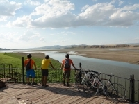
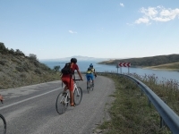
Selime
Difficulty Level
Length: 36 km
The route, which starts from Selime Monastery, goes down to Bekar Sultan Tomb after passing Gaziemir Underground City and passes by the shore of Balıklı Lake, and reaches the Gülağaç district.
Gülağaç
Difficulty Level
Length: 43 km
The route starts from Gülağaç District and continues through the Bekar Sultan Tomb. The road, which forms the climb bypassing the village where the Gaziemir Underground City is located, passes the town of Güzelyurt.
Aksaray
Difficulty Level
Length: 26 km
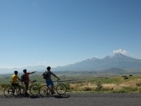
Starting from the ruins of Acemhöyük, the route passes through the village of Darıhöyük. It proceeds through the fields towards Hasandağı volcano. After passing the village of Yapılcan, he visits the Aksaray Museum and reaches the city center.
Aksaray
Difficulty Level
Length: 41 km
The route, which starts from Güvercin Kayası, goes around the Büyük Deller campus and starts climbing after reaching Aşıklı Höyük. As it approaches Güzelyurt, it descends and ends in Ihlara.
Aksaray
Diffculty Level
Length: 35 km
The route, which starts from Aksaray, passes through the Agzikarahan Caravanserai and reaches the underground city, which has special equipment with its underground church and tombs. The route then gets to Güvercin Kayası in Çatalsu village.
Alayhanı
Difficulty Level
Length: 43 km
The route, which starts from Alayhan Caravanserai on the Silk Road, reaches the town of Ortaköy, home to Yunus Emre's tomb, after climbing the village of Pörnekler.
Ortaköy
Difficulty Level
Length: 59 km
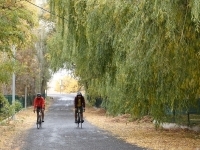
Starting with a gentle descent from Ortaköy, the route continues on a comfortable road to visit the tomb of Yunus Emre. Visiting the ponds in an idyllic environment, the path that reaches Agacören at the end of a flow away from traffic will provide you wi
Ağaçören
Difficulty Level
Length: 32 km
The route starts from Ağaçören village square and proceeds by going around the village by village. The road, which reaches the social facilities without entering the Sıdıklı - Sarıyahşi Bridge, returns to the Sarıyahşi district from this point.
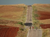
Sarıyahşi
Difficulty Level
Length: 84 km
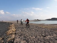
The route, which starts from the Hirfanlı Dam and stretches to the shores of Salt Lake, ends in the town of Yeşilova, built around the ruins of Acemhöyük.
Yeşilova
Difficulty Level
Length: 37 km
The route, which continues south of Salt Lake, ends in front of the Sultanhanı Caravanserai, which looks like a castle used as an encampment after reaching the Silk Road.
Sultanhanı
Difficulty Level
Length: 70 km
The route starts from Sultanhanı district. After taking a pleasant break in Salt Lake, the road, which climbs on a gently sloping ramp, reaches Sultanhanı after passing Eskil and visiting Eşmekaya.
Sultanhanı
Difficulty Level
Length: 61 km
The route, which starts from Sultanhanı Caravanserai on the Silk Road, reaches Aksaray on a straight road. Continuing in the shadow of Hasandağı volcano, it gets the town of Taşpınar, famous for its carpets.
Taşpınar
Difficulty Level
Length: 34 km
The route, which starts from Taşpınar, famous for its carpets, continues to the Ihlara Valley, passing by the Karkın village, following the Helvadere Pond.
Helvadere
Difficulty Level
Length: 43 km
The route starts from the village of Helvadere. After a pleasant descent, the mysterious structure containing a mummy proceeds on the road that climbs to the Çanlı Church. Later, it stops at the Aşıklı Höyük ruins and ends in Selime Monastery.
Aksaray
Difficulty Level
Length: 38 km
The route starts in Aksaray city center. After visiting the Somuncu Baba Tomb and reaching the fairy chimneys at 25 km, he starts climbing towards the town of Güzelyurt, an old Greek settlement.
Niğde
Difficulty Level
Length: 43,2 km
Starting from the Altunhisar district, the birthplace of Aşık Tahiri, one of the 19th-century folk poets, the route follows the paths that preserve the mystery of history.
Niğde
Difficulty Level
Length: 45 km
The route, which starts from a charming town built on the slope of the Melendiz Volcano, climbs the hill from the east side of the volcano to the north with pleasure.
Niğde
Difficulty Level
Length: 36,2 km
Following the cultural adventure in Anatolia, the route starts from Niğde and continues in this mystical atmosphere.
Niğde
Difficulty Level
Length: 34,6 km
The route, which has a calm and meditative character, starts from the city of Niğde, which was shaped by history.
Niğde
Difficulty Level
Length: 52,8 km
Starting from the historical city of Niğde, once the capital of Cappadocia, this long route begins to climb in the impressive geography of volcanoes.
Niğde
Difficulty Level
Length: 21,6 km
The route, which explores the ancient roads adorned with legends, starts in Niğde, the region's capital, for a long time.
Niğde
Difficulty Level
Length: 38,3 km
The route, which sets out from the ancient city of Tyana, which bears the traces of the cultural adventure experienced in Anatolia, rises gently and glides towards the Silk Road through the hills caused by the volcanoes.
Niğde
Difficulty Level
Length: 48 km
This extended route, which gives different emotions with its changing atmosphere, reaches 1950m by visiting the Gümüşler Monastery, which has an important historical place.
Niğde
Difficulty Level
Length: 76,1 km
Visiting the villages around the Aladağlar mountain range, this long route starts in Çamardı Town Center.
Niğde
Difficulty Level
Length: 80,6 km
This route, which requires good conditioning, starts the climb from the center of Niğde.
Niğde
Difficulty Level
Length: 47,9 km
The route, which visits structures from the Seljuk Period, starts from Niğde City Center.
Niğde
Difficulty Level
Length: 65,6 km
Niğde, indispensable for travelers with its history going back thousands of years, is also the starting point of this route.
Niğde
Difficulty Level
Length: 32,7 km
Heading towards the Konya Plain, this highly entertaining route follows a flat road decorated with small ups and downs.
Niğde
Difficulty Level
Length: 54,8 km
Visiting mountain villages above 1000m, the route starts from the town of Bor.
Niğde
Difficulty Level
Length: 38,8 km
The route, which starts with a pleasant climb from Çamardı District Square, built on the skirts of Aladağlar, proceeds between the fields, village by village.
Niğde
Difficulty Level
Length: 22,2 km
The route, which starts from Tyana, the capital of the Southern Cappadocia Kingdom, proceeds on a comfortable road following the aqueducts from the Roman Period.
Niğde
Difficulty Level
Length: 61,9 km
Ulukışla Train Station, which is a part of the cultural adventure experienced in Anatolia, is the beginning of this adventurous route.
Niğde
Difficulty Level
Length: 11,5 km
The route, which sets out from Niğde, carries the traces of the cultural adventure experienced in Anatolia.
Niğde
Difficulty Level
Length: 21,6 km
This route mainly attracts photographers and starts from Niğde, a cultural crossroads.
Kırşehir
Difficulty Level
Length:
Starting from Kırşehir, Turkey's first and only UNESCO-registered music city, the route begins to climb a gentle slope.
Kırşehir
Difficulty Level
Length:
The route, which starts from the astronomy center of Kırşehir, which makes you experience the mystical world of the 13th century, climbs for about 8km and then begins to descend on a pleasant slope.
Kırşehir
Difficulty Level
Length: 66,4 km
This long route, which cycles through the steppe villages of Kırşehir, the city of lovers, bards and scholars, glides calmly on an almost straight road after a gentle climb of 8km.
Kırşehir
Difficulty Level
Length: 51 km
This long route, which starts in Kırşehir, the city of bards that hosted Silk Road travelers and merchants for hundreds of years, provides the opportunity to see exquisite examples of Seljuk architecture.
Kırşehir
Difficulty Level
Length: 62 km
This long route, which has been home to the tombs of important religious scholars and folk heroes of Anatolia and has an astonishing cultural richness, starts in the city center of Kırşehir.
Kırşehir
Difficulty Level
Length: 75,5 km
This long route, which starts from the legend-filled streets of Kırşehir, the city of shrines, follows the quiet and serene steppe roads and reaches its highest point on the slopes of Baran Mountain (41.8km).
Kırşehir
Difficulty Level
Length: 47,2 km
The route, which starts from Kırşehir, an Anatolian city dotted with shrines and hosts an adventure of faith that has been going on for thousands of years, progresses on a wavy track and reaches Mucur District, famous for its carpets.
Kırşehir
Difficulty Level
Length: 22,5 km
Using quiet village roads, this route proceeds in a relaxed manner towards the Silk Road.
Kırşehir
Difficulty Level
Length: 47,7 km
The route, which starts from Kırşehir, the city of the famous musician Neşet Ertaş, adorned with legends, proceeds northwards on village roads away from traffic.
Kırşehir
Difficulty Level
Length: 37,7 km
The route, which starts from Kaman, which hosts the tomb of the famous folk poet Dadaloğlu, known for his lines "The state gave the sultan's edict about us, the mountains are ours", has a comfortable descent.
Kırşehir
Difficulty Level
Length: 43,5 km
The pedaling route in the geography where Anatolian saints lived, leaves behind the delicious smells of food spread on the streets smelling of history and floating calmly in the peace of nature.
Kırıkkale
Difficulty Level
Length: 44,6 km
This lively route, starting from Kırıkkale city center, explores the surprise-filled geography of Anatolia.
Kırıkkale
Difficulty Level
Length: 36,2 km
This route, which witnesses the cultural adventure of Anatolia, starts from Çeşnigir Bridge, which has served caravans for hundreds of years.
Kırıkkale
Difficulty Level
Length: 55,3 km
This pleasant route, which descends on a wavy road, starts from Keskin, a district that attracts travelers with its local tastes and photographic places.
Kırıkkale
Difficulty Level
Length: 60 km
This sportive route, most of which is climbing, starts from the charming industrial city of Kırıkkale, connecting 41 provinces.
Kırıkkale
Difficulty Level
Length: 51,6 km
Starting from the Republic city of Kırıkkale, whose foundations were laid in 1925, the route begins to climb towards the ancient lands of Central Anatolia, roasted by religion.
Kırıkkale
Difficulty Level
Length: 28,8 km
Starting from Kırıkkale, a young industrial city, the route passes Hacıbali Village at 15.6th km and stops at Obaköy/Yeşil Vadi, one of the most important entertainment and recreation areas of Kırıkkale, at the 13th km.
Kırıkkale
Difficulty Level
Length: 6,4 km
The route, which starts in Kırıkkale, a "key junction" located at the crossing point of 43 provinces, explores this huge garden that hosts many activities, and at the 4.2 km mark, it explores the National Garden, which gives pleasant moments, especially t
Kırıkkale
Difficulty Level
Length: 29,6 km
This very comfortable route, starting from Kırıkkale, a young city founded during the Republic period, follows Kızılırmak and reaches Balışeyh District, named after Şeyh Edebali, a close friend of Oğuz Kayı Bey Ertuğrul Gazi.
Kırıkkale
Difficulty Level
Length: 23,3 km
The route exploring the land of Bozlak, dotted with nostalgic mansions, starts from Sulu Cave, which gives exquisite photographs with its magical atmosphere.
Kırıkkale
Difficulty Level
Length: 4,8 km
The route, which uses the bicycle track of Yeşil Vadi, one of the most important entertainment and recreation areas of Kırıkkale, uses a flat track. The route, which proceeds through greenery along the way, ends in the center of Green Valley, which offers
Kırıkkale
Difficulty Level
Length: 30,5 km
This route, heading towards Kapulukaya Dam Lake built on the Kızılırmak, starts from Kırıkkale, a charming industrial city with a population of 300,000.
Kırıkkale
Difficulty Level
Length: 43,7 km
This sporty route, which starts from Keskin, a district adorned with mansions that carry the projection of the past to the present, completes the first 22km with a pleasant descent.
Ürgüp
Difficulty Level
Length: 10 km
Empty, smooth, comfortable roads
An exquisite journey in the countryside of Nevsehir
Karain: a village engraved in fairy chimneys
Mysteries all around
An exquisite journey in the countryside of Nevsehir
Karain: a village engraved in fairy chimneys
Mysteries all around
Ürgüp
Difficulty Level
Length: 18 km
St. Theodore Church; a unique church with its large gallery.
Karain: the village where time stands still.
Secluded roads winding through fields
Life carved into fairy chimneys
Karain: the village where time stands still.
Secluded roads winding through fields
Life carved into fairy chimneys

Ürgüp
Difficulty Level
Length:
Travelling with the breeze of Erciyes Volcano
Comfortable clean, secluded asphalt roads
Life carved into rocks,
Mystical villages away from tourism
Comfortable clean, secluded asphalt roads
Life carved into rocks,
Mystical villages away from tourism
Ürgüp
Difficulty Level
Length: 20 km
Smooth roads through surreal geography.
Fantastic legends and stories.
Discovering the highlights of the region at your own pace.
Panorama points for stunning photos.
Fantastic legends and stories.
Discovering the highlights of the region at your own pace.
Panorama points for stunning photos.
Göreme
Difficulty Level
Length: 10 km
Meeting with fantastic patterns
Comfortably descending route
Stunning view of St. John the Baptist Chapel and the plateau
Enjoyable camping opportunity
Comfortably descending route
Stunning view of St. John the Baptist Chapel and the plateau
Enjoyable camping opportunity
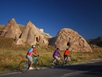
Avanos
Difficulty Level
Length: 23 km
Fairytale roads untouched by tourism
Clean asphalt roads, a surreal geography
Riding freely with the breeze of the lake and river
Camping near the thermal pool
Clean asphalt roads, a surreal geography
Riding freely with the breeze of the lake and river
Camping near the thermal pool
Bayramhacılı
Difficulty Level
Length: 19 km
The stunning riot of colours for photographers
Pleasure in the warmth of the thermal pool
Dance of Kizilirmak with the tuff structure
Pleasure in the warmth of the thermal pool
Dance of Kizilirmak with the tuff structure
Sarıhıdır
Difficulty Level
Length: 23 km
Zelve: An ancient settlement carved into fairy chimneys
Camping at the intersection of famous valleys
Visit the highlights of Cappadocia
Riding with a unique view.
Camping at the intersection of famous valleys
Visit the highlights of Cappadocia
Riding with a unique view.
Göreme
Difficulty Level
Length: 14 km
From mysterious tunnels to gigantic fairy chimneys
Reflection of different ages in volcanic ash
A huge city carved under Nevsehir Castle
A smooth ramp between castles
Reflection of different ages in volcanic ash
A huge city carved under Nevsehir Castle
A smooth ramp between castles

Nevşehir
Difficulty Level
Length: 28 km
Nostalgia in the streets of Nevsehir
The mystery of thousands of years of the adventure of culture
Descents with feelings in every trail
The mystery of thousands of years of the adventure of culture
Descents with feelings in every trail
Gülşehir
Difficulty Level
Length: 33 km
Comfortable roads by the river
Conical forms; miracles of a supervolcano
Goreme in the UNESCO World Heritage List.
Conical forms; miracles of a supervolcano
Goreme in the UNESCO World Heritage List.
Uçhisar
Difficulty Level
Length: 41 km
Roads that have hosted thousands of racers
Trails with different characteristics
Fabulous settlements, stunning landscapes.
Trails with different characteristics
Fabulous settlements, stunning landscapes.
Uçhisar
Difficulty Level
Length: 108 km
The route cycled by world-famous cyclists
Turkey's longest bicycle race route
Settlements that bend time
Trails away from traffic in the countryside.
Turkey's longest bicycle race route
Settlements that bend time
Trails away from traffic in the countryside.
Ürgüp
Difficulty Level
Length: 12 km
Life carved into rocks
The breeze of Istanbul in Cappadocia; Mustafapasa
Ayvali on the slope of the Gomeda Valley
The breeze of Istanbul in Cappadocia; Mustafapasa
Ayvali on the slope of the Gomeda Valley
Ayvalı
Difficulty Level
Length: 23 km
Huge potato warehouses
Details from village life
2 underground cities in a different style
Comfortable, smooth trails
Details from village life
2 underground cities in a different style
Comfortable, smooth trails
Ürgüp
Difficulty Level
Length: 17 km
Mustafapasa with its madrasah, rock houses, and impressive mansions
The mysterious Keslik Monastery with mystical murals
Cemil: a village carved in rocks
Urgup presents the past and the present together
The mysterious Keslik Monastery with mystical murals
Cemil: a village carved in rocks
Urgup presents the past and the present together
Ürgüp
Difficulty Level
Length: 9 km
Nevsehir's only known Roman settlement with mosaics
The mysterious Keslik Monastery with legends hidden in green
Taskinpasa Complex built by the Seljuks
Roads that all cyclists can enjoy.
The mysterious Keslik Monastery with legends hidden in green
Taskinpasa Complex built by the Seljuks
Roads that all cyclists can enjoy.
Şahinefendi
Difficulty Level
Length: 21 km
Cool down with your own wind down the ramp
2 underground cities with different structures
Trails away from traffic through the fields
The countryside of Nevsehir.
2 underground cities with different structures
Trails away from traffic through the fields
The countryside of Nevsehir.
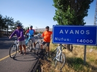
Avanos
Difficulty Level
Length: 15 km
Avanos; turning craft into art
The trail that offers a comfortable ride on dirt roads
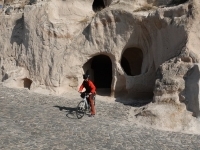
The underground city, a part of the mystery of Cappadocia
The trail that offers a comfortable ride on dirt roads
The underground city, a part of the mystery of Cappadocia
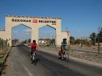
Özkonak
Difficulty Level
Length: 47 km
Ozkonak Underground City; 4 floors underground
Enjoying massage in Kozakli hot springs
Trails away from traffic through the fields
Enjoying massage in Kozakli hot springs
Trails away from traffic through the fields
Hacıbektaş
Difficulty Level
Length: 49 km
Symbols thousands of years of the adventure of faith
The pleasure of descending on comfortable roads
Relaxing, meditative ride along Kizilirmak
Avanos, giving meaning to clay
The pleasure of descending on comfortable roads
Relaxing, meditative ride along Kizilirmak
Avanos, giving meaning to clay
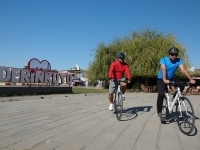
Derinkuyu
Difficulty Level
Length: 68 km
Acigol Volcanic Complex: Last eruption in 2080 ± 200 BC
Marrs (crater pits filled with water) that make Acigol special
Derinkuyu Underground City with its incredible structures
Trails away from traffic
Marrs (crater pits filled with water) that make Acigol special
Derinkuyu Underground City with its incredible structures
Trails away from traffic
Derinkuyu
Difficulty Level
Length: 40 km
Stunning geology of the region
A comfortable ride on smooth roads
Yazihuyuk, calling the explorers on the way
Settlements that bend time underground
A comfortable ride on smooth roads
Yazihuyuk, calling the explorers on the way
Settlements that bend time underground
Derinkuyu
Difficulty Level
Length: 72 km
Surreal structures carved underground
The black-red landscape created by volcanic activities
Unprecedented geological wonders
Icons from ancient times.
The black-red landscape created by volcanic activities
Unprecedented geological wonders
Icons from ancient times.
Nevşehir
Difficulty Level
Length: 35 km
Ottoman Architecture in the city of Damat Ibrahim Pasha
Time-bending underground city
Oaks growing in the lava bed
Different cultural patterns of Nevsehir
Time-bending underground city
Oaks growing in the lava bed
Different cultural patterns of Nevsehir
Tatlarin
Difficulty Level
Length: 30 km
Thousands of years of the adventure of faith
Continuously inhabited Gokcetoprak
Traces of the first peoples of Anatolia
The mysterious Tabal Kingdom is mentioned in the Torah
Continuously inhabited Gokcetoprak
Traces of the first peoples of Anatolia
The mysterious Tabal Kingdom is mentioned in the Torah
Ovaören
Difficulty Level
Length: 38 km
The ambience of ancient times
Huge salt blocks in Tuzkoy
First dynamic, then relaxing ride
Mysterious roads away from traffic.
Huge salt blocks in Tuzkoy
First dynamic, then relaxing ride
Mysterious roads away from traffic.
Gülşehir
Difficulty Level
Length: 28 km
Route filled with stories and legends
Ancient cultures blended with faith in Anatolia
Secluded roads through fields
Ancient cultures blended with faith in Anatolia
Secluded roads through fields