


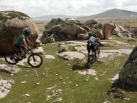
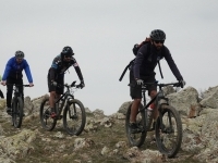
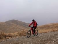
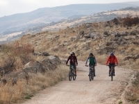
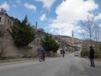
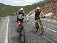
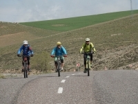
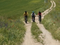
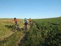
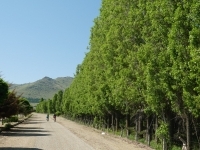
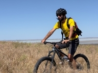
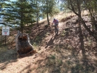
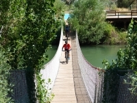
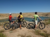
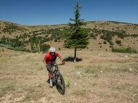
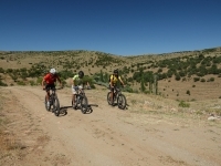
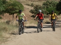
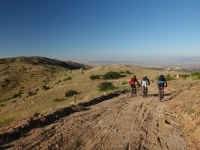
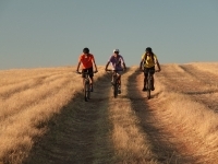
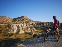
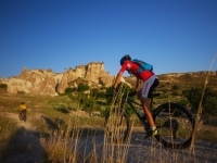
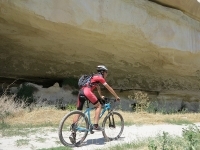
Mountain Bike Routes

Add To My To Do List
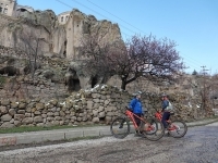
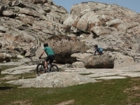
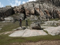
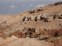
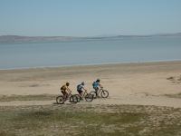
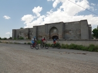
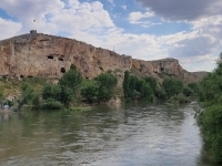
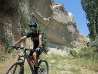
Güzelyurt, Gaziemir, Sofular, Narlıgöl
Physical
Difficulty Level
Technical
Length: 23
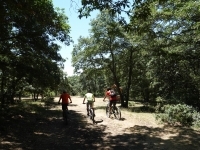
This photogenic route with a very mystical atmosphere starts with a gentle descent and ends with a sweet ramp that climbs into an exquisite crater. Witnessing the unique architecture of Güzelyurt Town, an important Greek settlement, the route follows calm
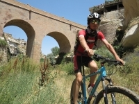
Aşıklı Höyük, Selime, Ihlara Valley, Belisırma, Güzelyurt
Physical
Technical
Length: 23,8
The route following the Melendiz River begins in Aşıklı Höyük, one of the villages where the transition of humanity to settled life took place. The path, which proceeds in a straight course along the river, stops by Selime Monastery, the next cultural sto
Ihlara, Ilısu, Güzelyurt
Physical
Technical
Length: 10,5
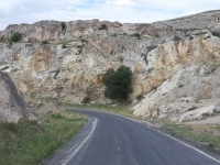
Following the Melendiz River over the canyon, the route, after stopping by the Ilısu Village, takes the Hasandağı Mountain behind it and heads towards the old Greek village of Güzelyurt, a fairy-tale settlement. On the way, he visits the High Church, whic
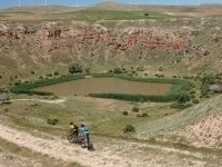
Ağaçören, Güzelöz, Sarıhasan, Boğazköy
Physical
Technical
Length: 18,3 km
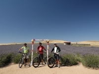
Starting from the town center of Ağaçören, the route passes through vineyards and pumpkin fields and visits the villages. The track, which has a comfortable ride, starts with light ups and downs and descends towards Boğazköy Pond, which gives lovely photo
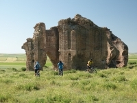
Somuncu Baba Tomb, Akhisar, Çanlı Kilise, Yuva
Physical
Technical
Length: 26,1 km
Accompanied by the magnificent mountain scenery, this route proceeds towards the countryside, visiting the Tomb of Somuncu Baba, whose real name is Şeyh Hamid-i Veli, one of the Anatolian saints. The route, which proceeds towards Hasandağı on a dirt road
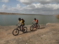
Somuncu Baba Tomb, Gençosman, Gücünkaya (Mamasın Dam)
Physical
Technical
Length: 14,5 km
Starting from the tomb of Sheikh Hamid-i Veli, known as Somuncu Baba, one of the famous saints of Anatolia, the route proceeds on undulating paths after a short climb out of the city.
Balcı Pond, Cumali Pond, Çetin Pond, Yanyurt, Tapduk Emre
Physical
Technical
Length: 21,2 km
The route in front of the Hasandağı volcano visits the ponds accompanied by magnificent landscapes and reaches the village of Yanyurt at 15 km.
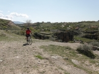
Boğazköy, Sarıyahşi, Sarıyahşi-Sıdıklı Bridge
Physical
Technical
Length: 18,5 km
Rota starting from Boğazköy, after climbing on a sweet ramp of 3 km, it goes down.
Ekecikyeni, Goksu Guzel, Susdagi, Tatlica, Babakonagi
Physical
Technical
Length: 21,6
Visiting the villages around Ekecek Mountain, which offers impressive views with its different geography, the route starts on a wavy path and descends at 9 km.
Gökçe, Mamasın Barajı, Gücünkaya, Sevinçli
Physical
Technical
Length: 11,7 km
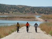
The route, which starts from Gökçe Village, which has a magnificent view of the Mamasin Dam, passes the caves and churches hidden on the plateau overlooking the pond and reaches the village of Güçlükaya with a not-too-hard descent.
Gücünkaya, Mamasın Barajı, Gökçe
Physical
Technical
Length: 8,38 km
The route, which starts from Gücünkaya Village, reaches Mamasin Pond by following slightly bumpy paths. The paths that go into the depths of history, accompanied by the impressive pond view, end in Gökçe village.
Hacıahmetli Tepe Köy, Çiftevi, Çiftevi Barajı, Camili, Ağaçören
Physical
Technical
Length: 19,7 km
The route, which proceeds by following the dams built on the streams feeding the Kızılırmak, follows epic paths. It descends with a slight incline until Ciftevi Dam and after climbing for 5 km, it descends to Camili Village.

Helvadere
Physical
Technical
Length: 13,6
The route, which starts just below the ancient city of Mokissos, hidden in the shadow of Hasandağı, passes the Helvadere Pond and glides gently down through the fields.
Ortaköy
Physical
Technical
Length: 23 km
The route, which visits the villages accompanied by idyllic landscapes, starts with climbing and visits the villages by following the fast and then slow paths right after passing Namlıkışla Village.
Ortaköy
Physical
Technical
Length: 14,3 km
The route, which sets out from the town where the famous Anatolian dervish Yunus Emre lives, guiding us even today with his philosophy that goes beyond the centuries, descends towards the heart of the dam on a gently sloping land.
Ortaköy
Physical
Technical
Length: 13,4 km
Starting from Ortaköy, this comfortable route allows young cyclists to rest in the town center of Balcı after reaching Balcı Pond with pleasant views.

Physical
Technical
Length: 25,3 km
The route, which provides an active ride with its low ups and downs, follows the mystical centers of the region.
Sevinçli, Çeltek, Uzun kaya, Selime
Physical
Technical
Length: 19,3 km
The route has a quiet course, ascends slightly with idyllic landscapes, and descends just before reaching Uzunkaya village.
Aksaray
Physical
Technical
Length: 30,3 km
Starting from Taptuk Emre's tomb, the route glides silently down through fields.
Aksaray
Physical
Technical
Length: 25,9 km
The route, which uses the fairy-tale paths of Anatolia adorned with legends, starts from the tomb of Anatolian saint Yunus Emre.
Niğde
Physical
Technical
Length: 21,8 km
The route, which starts from Kömürcü village, is located on the skirts of Göllüdağ, which hosts an old temple, finishes the 7.5 km descent, and reaches the charming town of Kiledere, which is located on the plain.
Niğde
Physical
Technical
Length: 17,5 km
The route, which explores these lands that have hosted different cultures for thousands of years, starts from the foothills of Göllüdağ, which is famous for its temple from the Tabal Kingdom.
Niğde
Physical
Technical
Length: 5,45 km
Starting from the village of Kömürcü, built on the slopes of an extinct volcano, the route reaches the crater on gently ascending paths to visit the temple, which bears the traces of the ancient civilizations of Anatolia.
Niğde
Physical
Technical
Length: 25,5 km
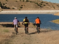
Starting from the north of Narlı Göl, the route heads south, with the breathtaking view of the lake behind it.
Niğde
Physical
Technical
Length: 32,5 km
The route, which visits the villages with idyllic landscapes, starts from Çiftlik village, built on plain land.
Niğde
Physical
Technical
Length: 29,8 km
The route, which explores the volcanic terrain with its lively character, starts from Çiftlik village, located east of Hasan Mountain volcano.
Niğde
Physical
Technical
Length: 18,4 km
The route, which starts from the plain village Çiftlik at an altitude of 1500m, proceeds in the volcanic region of Cappadocia.
#28 Ketençimen Ski Center – Pınarcık - Yayla Yolu – Ballı – Tepeköy - Yeşilburç
Add To My To Do List
Niğde
Physical
Technical
Length: 31,6 km
Visiting Anatolian villages bearing traces of different cultures and religions, the route starts from Ketençimen Ski Center.
Niğde
Physical
Technical
Length: 16,5 km
The route blends the region's geography with history by providing an active ride with low ups and downs.
Niğde
Physical
Technical
Length: 14,7 km
The route, which starts from the Gebere Dam in the Uzandı Valley, a place frequented by nature enthusiasts, passes the charming Anatolian villages with a comfortable drive.
Niğde
Physical
Technical
Length: 24,8 km
Starting from the village of Gölcük, which draws attention with its pond, the route climbs gently between fields until the 16th km.
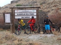
Niğde
Physical
Technical
Length: 32,7 km
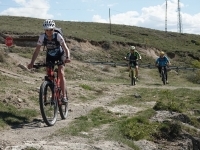
The route, which proceeds at the foot of a 550 km² Aladağlar range, starts from the mountain village of Sulucaova, which has an altitude of 1800 m.
Niğde
Physical
Technical
Length: 13 km
Starting from the mountaineer-friendly village of Demirkazık, the route takes you into an adventure that is as challenging as fun.
Niğde
Physical
Technical
Length: 30,1 km
The route, which starts from Demirkazık village, reaches the Sokullupınar Camping Area at the 5th km, taking in the magnificent view.
Niğde
Physical
Technical
Length: 53 km
The route, which explores the Aladaglar range, which attracts travelers and mountaineers with its stunning geography, starts from the mountaineer-friendly village of Demirkazık.
Niğde
Physical
Technical
Length: 27,2 km
Starting from Başmakçı, built on a plain on the Silk Road, this fun route climbs slightly after leaving the village and descends on an undulating route.
Niğde
Physical
Technical
Length: 20 km
Starting from Meydan Plateau, where plateau flowers bloom, the route takes the Bolkar Mountains to its right.
Niğde
Physical
Technical
Length: 41,3 km
The route, decorated with mystical motifs, starts from the Bor district center, famous for its delicious curd.
Kırşehir
Physical
Technical
Length: 49,8 km
The route that goes around Seyfe Lake (15 km²), which is home to birds such as flamingos, cranes, ducks, and angulls, offers an enjoyable experience to active drivers with its lively structure.
Kırşehir
Physical
Technical
Length: 16 km
Starting from Mucur Underground City, which has surprising details and was discovered during road work, the route passes through the villages of bards (Bozlaks) who tell about tribal fights, blood feuds, and love adventures.
Kırşehir
Physical
Technical
Length: 29,5 km
Starting from Boztepe District, the route gently glides through fields and visits steppe villages.
Kırşehir
Physical
Technical
Length: 16,2 km
Starting from Çiçekdağı, the hometown of the famous Neşet Ertaş, the last great representative of the Abdal tradition, the route progresses through the steppe, which is a place for deserts.
Kırşehir
Physical
Technical
Length: 30,4 km
Reaching an altitude of 1400m, this idyllic route proceeds on a dirt road through the plateaus, following the gentle rhythm of the mountainous terrain.
Kırşehir
Physical
Technical
Length: 32,8 km
Starting from Akçakent District, which has a cute picnic area, the route provides an active ride with its low ascents and descents.
Kırşehir
Physical
Technical
Length: 37,7 km
This sportive route climbs for 14 km, visiting villages accompanied by idyllic landscapes.
Kırşehir
Physical
Technical
Length: 27,4 km
The route, which starts from Kaman, full of surprises, visits steppe villages accompanied by epic views.
Kırşehir
Physical
Technical
Length: 28,6 km
Starting from Kırşehir, the place of the saints, the route progresses on a gentle slope for about 10 km.
Kırşehir
Physical
Technical
Length: 13,6 km
This oasis, located about 20 km north of Kırşehir, surrounds the Çoğun Dam Lake, which gives wonderful photographs, especially at sunset.
Kırşehir
Physical
Technical
Length: 18,5 km
Starting from Kırşehir, which fascinates travelers with its streets adorned with legends, the route follows gently bumpy paths and reaches the village of Seviyorum in the greenery.
Kırşehir
Physical
Technical
Length: 22 km
Starting from Kaman District, famous for its walnuts, the route follows a comfortable course and reaches the Japanese Garden, which amazes travelers.
Kırıkkale
Physical
Difficulty Level
Technical
Difficulty Level
Length: 5,5 km
This route, which is very close to the city center, starts right behind the Kırık Village Mosque. Rising on a slight slope, the track overlooks Kırıkkale after 2.6km.
Kırıkkale
Physical
Difficulty Level
Technical
Difficulty Level
Length: 4,84 km
The route, which uses the bicycle track of Yeşil Vadi, one of the most important entertainment and recreation areas of Kırıkkale, uses a flat track.
Kırıkkale
Physical
Difficulty Level
Technical
Difficulty Level
Length: 9,32 km
This unique route, which starts from the tomb of Hasandede, a saint known for his miracles as well as his sheikhship, military service, and poetry, leads you to unexpected beauties.
Kırıkkale
Physical
Difficulty Level
Technical
Difficulty Level
Length: 43 km
This route, which attracts experienced cyclists, starts from the Çeşnigir Bridge, which is rumored to have passed over Timur, who was advancing towards the Battle of Ankara in 1402, and which was rebuilt by Mimar Sinan by Yavuz Sultan Selim years later.
Kırıkkale
Physical
Difficulty Level
Technical
Difficulty Level
Length: 16 km
The route, which blends the geography of the region with history, starts from the Çeşnigir Bridge on the old caravan route and flows into the legend-filled atmosphere of Anatolia.
Kırıkkale
Physical
Difficulty Level
Technical
Difficulty Level
Length: 19,3 km
This route, which invites travelers to adventure, starts from a pleasant activity park where you can experience horseback riding and archery activities.
Kırıkkale
Physical
Difficulty Level
Technical
Difficulty Level
Length: 19,4 km
The route, which starts at the summit of Dinek Mountain opening to Anatolia, almost floats into infinity on empty paths.
Kırıkkale
Physical
Difficulty Level
Technical
Difficulty Level
Length: 20,6 km
Starting from Konur Village, founded by nomadic Turkmen who came hundreds of years ago during the Mongol invasion, the route progresses from village to village in the silence of the steppe.
Kırıkkale
Physical
Difficulty Level
Technical
Difficulty Level
Length: 10 km
This comfortable route, wandering in the blue of Kaplukaya Dam Pond, leaves Karaahmetli Village and proceeds towards the riot of colors.
Kırıkkale
Physical
Difficulty Level
Technical
Difficulty Level
Length: 38,3 km
This mystical route, which visited the saints who came to Anatolia in the 13th century, visits villages adorned with legends.
Kırıkkale
Physical
Difficulty Level
Technical
Difficulty Level
Length: 21,3 km
Climbing the first 4.3km, the route follows the paths flowing in silence and descends on a very slightly inclined ramp.
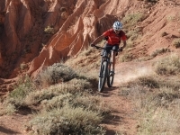
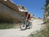
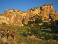
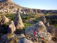
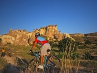
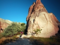
Göreme – Çavuşin – Paşabağ – Zelve
Physical
Technical
Length: 8 km
Journey to the three-headed fairy chimneys
Stunning view of St. John the Baptist Chapel and the plateau
Zelve; an old village in the red
Life embedded in surreal formations.
Stunning view of St. John the Baptist Chapel and the plateau
Zelve; an old village in the red
Life embedded in surreal formations.
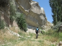
Zelve
Physical
Technical
Length: 16 km
Journey to the Silk Road: Saruhan Caravanserai
Cycling in the Valley of Dreams
Fairytale roads untouched by tourism
Cycling in the Valley of Dreams
Fairytale roads untouched by tourism
Sarıhıdır
Physical
Technical
Length: 20 km
Relaxing ride along Kizilirmak
Avanos; the famous ceramic centre
Goreme with a colourful history and culture
Avanos; the famous ceramic centre
Goreme with a colourful history and culture
Göreme
Physical
Technical
Length: 11 km
Iconic formations of Goreme
Touching the countryside of Nevsehir
Constantly changing adventurous trails
Spectacular view for photography
Touching the countryside of Nevsehir
Constantly changing adventurous trails
Spectacular view for photography
Kavak
Physical
Technical
Length: 15 km
Village life on the slopes of fairy chimneys
Tracks on the lunar surface created by the volcanic tuff
The pleasure of descending with your own wind
Stream crossings in the lush paradise of Gomeda
Tracks on the lunar surface created by the volcanic tuff
The pleasure of descending with your own wind
Stream crossings in the lush paradise of Gomeda
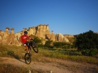
Ürgüp
Physical
Technical
Length: 14 km
Colourful valleys straight out of a fairy tale
Playful tracks that will awaken the child in you
Surreal geological formations
Murals: A window to the past
Playful tracks that will awaken the child in you
Surreal geological formations
Murals: A window to the past
Göreme
Physical
Technical
Length: 40 km
Village life carved into rocks
Tracks on the lunar surface created by the volcanic tuff
Stream crossings and jumps in the lush paradise of Gomeda
Dovecotes, basilicas, churches were encountered unexpected moments.
Tracks on the lunar surface created by the volcanic tuff
Stream crossings and jumps in the lush paradise of Gomeda
Dovecotes, basilicas, churches were encountered unexpected moments.
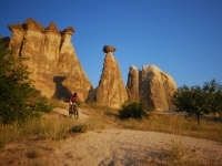
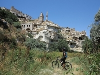
Uçhisar
Physical
Technical
Length: 10 km
Uchisar town, a giant fairy chimney
Goreme, famous for its old windmills
An easy track with pleasant descents
A track that all cyclists can easily cycle
Goreme, famous for its old windmills
An easy track with pleasant descents
A track that all cyclists can easily cycle
Göre
Physical
Technical
Length: 7 km
A closer look at Ottoman Architecture
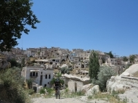
The old town of Gore, which stretches the imagination
Curvy descent after a difficult ascent
The settlement carved into the hill connected to Nevsehir Castle
The old town of Gore, which stretches the imagination
Curvy descent after a difficult ascent
The settlement carved into the hill connected to Nevsehir Castle
Nevşehir
Physical
Technical
Length: 14 km
From mysterious tunnels to gigantic fairy chimneys
Reflection of different ages in volcanic ash
A huge city carved under Nevsehir Castle
Journey on a smooth ramp between castles.
Reflection of different ages in volcanic ash
A huge city carved under Nevsehir Castle
Journey on a smooth ramp between castles.
Uçhisar
Physical
Technical
Length: 6 km
Comfortable ride for all ages
The breathtaking view of Uçhisar Castle
Bird's eye view of Güvercinlik Valley
A brief look at the streets of Goreme
The breathtaking view of Uçhisar Castle
Bird's eye view of Güvercinlik Valley
A brief look at the streets of Goreme
Göreme
Physical
Technical
Length: 21 km
Journey to the most popular spots of fantasy
Excitement on paths out of a fairy tale
Hidden churches, green valleys
Easy trails embracing all cyclists
Excitement on paths out of a fairy tale
Hidden churches, green valleys
Easy trails embracing all cyclists
Göreme
Physical
Technical
Length: 14 km
Uchisar Castle: The famous fairy chimney of Nevsehir
Enjoyable wavy tracks of Baglidere (Akvadi)
Cavusin: The set of many movies with its incredible geography
Camping opportunity in the town
Enjoyable wavy tracks of Baglidere (Akvadi)
Cavusin: The set of many movies with its incredible geography
Camping opportunity in the town
Göreme
Physical
Technical
Length: 19 km
Paths that make you stop and take photos along the way
Enjoyable wavy tracks of Akvadi
Iconic fairy chimneys of Love Valley
Churches and monasteries were carved into chimneys in Kiliclar Valley.
Enjoyable wavy tracks of Akvadi
Iconic fairy chimneys of Love Valley
Churches and monasteries were carved into chimneys in Kiliclar Valley.
Göreme
Physical
Technical
Length: 17 km
The indispensable places of a journey in Nevsehir
Stunning view of St. John the Baptist Chapel and the plateau
Comfortable, unexacting trails
Iconic formations, surreal landscapes.
Stunning view of St. John the Baptist Chapel and the plateau
Comfortable, unexacting trails
Iconic formations, surreal landscapes.
Ürgüp
Physical
Technical
Length: 14 km
Breathtaking view of Meskendir Valley
Encounter with early church paintings
Enjoyable paths through reddish scenery.
Encounter with early church paintings
Enjoyable paths through reddish scenery.
Göreme
Physical
Technical
Length: 14 km
Kızılçukur Valley
Physical
Technical
Length: 4 km
Enjoyable paths through a reddish scenery
Short, practical track where you can test yourself
Encounter with early church paintings in the Crusader Church
Short, practical track where you can test yourself
Encounter with early church paintings in the Crusader Church
Çavuşin
Physical
Technical
Length: 10 km
The fascinating Love Valley of Nevsehir with iconic fairy chimneys
Fruit trees and vineyards on white tuff
Panoramic view of the red valleys of Bozdag
Lively paths
Fruit trees and vineyards on white tuff
Panoramic view of the red valleys of Bozdag
Lively paths
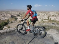
#81 Göreme - Swords Valley - Rose & Red Valleys - Love Valley - Zemi Valley - Göreme
Add To My To Do List
Göreme
Physical
Technical
Length: 33 km
Steep technical ascend on the terraced gardens of Gulludere Valley.
The “Panorama Route” competes with world-famous mountain bike trails such as Moab.
Fast, pass-through trails, descents, and jumps through Zemi Valley.
Enjoyable downhill trails of Gork
The “Panorama Route” competes with world-famous mountain bike trails such as Moab.
Fast, pass-through trails, descents, and jumps through Zemi Valley.
Enjoyable downhill trails of Gork
Kavak
Physical
Technical
Length: 9 km
A comfortable descent in a surreal geography
The panorama that bends time: Ortahisar Castle
Life away from tourism
Comfortable tracks are suitable for everybody.
The panorama that bends time: Ortahisar Castle
Life away from tourism
Comfortable tracks are suitable for everybody.
Ortahisar
Physical
Technical
Length: 7 km
Ortahisar Castle; a giant fairy chimney
Popular settlements for photography tours
Scenic descent from the ridge of Meskendir Valley
Popular settlements for photography tours
Scenic descent from the ridge of Meskendir Valley
Ortahisar
Physical
Technical
Length: 7 km
Ishak Pasha Castle; an indispensable place for photography tours
A comfortable descent through dirt roads
Urgup, hosting the past and present together
A comfortable descent through dirt roads
Urgup, hosting the past and present together
Çat
Physical
Technical
Length: 8 km
The famous fairy chimney called "Mushroom Rock"
A quiet and smooth descent with the chirping of birds
Sulusaray; an incredible Byzantine settlement
Pleasant descent on the valley floor.
A quiet and smooth descent with the chirping of birds
Sulusaray; an incredible Byzantine settlement
Pleasant descent on the valley floor.
Acıgöl
Physical
Technical
Length: 14 km
Acigol volcanic complex
Red obsidian bed
Discovering rare formations of the earth
Red obsidian bed
Discovering rare formations of the earth
Göreme
Physical
Technical
Length: 28 km
"The Rhythm of Life Project" covers 13 countries
Gigantic statues by Andrew Rogers
The majestic fairy chimney of Nevsehir
Avanos; a paradise of ceramics
Gigantic statues by Andrew Rogers
The majestic fairy chimney of Nevsehir
Avanos; a paradise of ceramics
Avanos
Physical
Technical
Length: 16 km
Avanos; turning craft into art
The trail that offers a comfortable ride on dirt roads
The underground city, a part of the mystery of Cappadocia.
The trail that offers a comfortable ride on dirt roads
The underground city, a part of the mystery of Cappadocia.

Avanos
Physical
Technical
Length: 24 km
Journey to the countryside following Kizilirmak
The stunning riot of colours for photographers
Comfortable, pleasant, straight paths
Avanos; turning clay into art
The stunning riot of colours for photographers
Comfortable, pleasant, straight paths
Avanos; turning clay into art
Bozca
Physical
Technical
Length: 8 km
Old Bozca village with pristine stone houses
Fresh breeze of Bayramhaci Dam
Sofular; a village with a million-year-old fossil beds
Fresh breeze of Bayramhaci Dam
Sofular; a village with a million-year-old fossil beds
Sofular
Physical
Technical
Length: 16 km
A pleasant descent on comfortable dirt roads,
Breathing the fresh air of the countryside
Sofular, known for millions of years-old fossils
Urgup, a developed settlement presenting the present and the past together
Breathing the fresh air of the countryside
Sofular, known for millions of years-old fossils
Urgup, a developed settlement presenting the present and the past together
Hacıbektaş
Physical
Technical
Length: 30 km
Hirka Mountain, which brought Haci Bektas together with the saints
Meditative, calm, unexacting trails
Ancient cultures blended with faith in Anatolia
Meditative, calm, unexacting trails
Ancient cultures blended with faith in Anatolia
Mustafapaşa
Physical
Technical
Length: 13 km
Mustafapasa with its madrasah, rock houses, and impressive mansions
Mystical feelings away from civilization on Golgoli Hill
Relaxing, wavy trails on the descents
Lush Keslik Monastery
Mystical feelings away from civilization on Golgoli Hill
Relaxing, wavy trails on the descents
Lush Keslik Monastery
Mustafapaşa
Physical
Technical
Length: 9 km
Nevsehir's only known Roman settlement
Keşlik Monastery with mystical paintings and patterns
Taskinpasa Complex built by the Seljuks
Keşlik Monastery with mystical paintings and patterns
Taskinpasa Complex built by the Seljuks
Şahinefendi
Physical
Technical
Length: 11 km
The only Roman period ancient city in Nevsehir
Feeling of freedom at 1500 m
Exploring the high plain hills unique to Nevsehir
Touching the countryside of Nevsehir
Feeling of freedom at 1500 m
Exploring the high plain hills unique to Nevsehir
Touching the countryside of Nevsehir